Last updated:
Site Boundary Verification Checklist for Feasibility
TL;DR
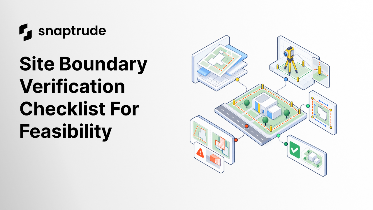
A site boundary verification checklist confirms that the line used for feasibility has a known source, coordinate system, datum, purpose, accuracy, date, and review status. It also records conflicts and assumptions before the boundary drives setbacks, floor-area calculations, parking, massing, or a go/no-go decision.
What is a site boundary verification checklist?
A site boundary verification checklist is a structured review of the parcel geometry used in an architectural feasibility study. It does not replace a legal boundary determination or a professional survey. It establishes whether the available geometry is suitable for the current purpose, identifies what remains uncertain, and prevents a provisional line from quietly becoming the basis for precise conclusions.
That distinction matters because several documents can describe the same site differently. A title plan may show the general extent of ownership. A planning map may support an early desktop review. A topographic survey may record physical features and levels. A cadastral record, deed, easement document, or highway record may add a different legal or geometric constraint. None should be relabeled as something it is not.
RICS says a topographic survey can help confirm that a proposed project is located and fits correctly, while the accuracy required depends on the survey's purpose. It also advises checking the relevant highway authority where a boundary meets a public highway or right of way. Those are practical reminders that both intended use and adjacent authority records affect boundary confidence. (RICS guidance on topographic surveys and boundaries)
At minimum, the boundary record should capture:
1. Source document and issuing authority
2. Surveyor, date, and stated purpose
3. Coordinate reference system and vertical datum
4. Drawing units and scale
5. Claimed or specified accuracy
6. Physical monuments or control points
7. Adjacent roads, rights of way, and easements
8. Known conflicts between sources
9. Person responsible for resolution
10. Status: provisional, verified for feasibility, or verified for the next project stage
Why should the site boundary be verified before feasibility?
The site boundary should be verified first because nearly every geometric result inherits it. A setback is measured from a line. Site area is calculated inside it. Coverage and floor-area ratios use that area. Parking, fire access, landscape, and building footprints compete for the space it encloses. Moving one edge later can invalidate an otherwise careful option study.
The problem is not that early information is always incomplete. Early information will often be incomplete. The problem is presenting a result with more confidence than its inputs support. A concept based on a planning map may be useful for screening if the team clearly labels the boundary as provisional and tests a reasonable tolerance. The same map may be unsuitable for a land transaction, planning submission, or construction decision.
HM Land Registry explains that most registered title plans show general boundaries rather than the exact line, and it describes a separate determined-boundary process in England and Wales. The jurisdictional details vary, but the working principle travels well: understand what the source represents before treating its geometry as exact. (HM Land Registry property-boundary guidance)
See how a wider architectural site analysis connects boundary, context, regulation, and feasibility.
Explore Snaptrude with one verified site record, then test how every feasibility option responds when a boundary assumption changes.
How do you use a site boundary verification checklist?
Use the checklist in a fixed sequence: identify the decision, collect sources, normalize geometry, test conflicts, assign confidence, and record the next verification action. Starting with the intended decision keeps the exercise proportionate.
1. Define the decision and required confidence
Write down what the boundary will support. An initial site-screening study, a bid decision, a planning submission, and a construction layout require different evidence and accuracy. Ask the surveyor or responsible consultant to state whether the available material is fit for that purpose.
2. Inventory every boundary source
Collect the original files rather than relying on screenshots or redrawn lines. Record the issuing organization, document date, revision, units, scale, coordinate system, and any disclaimer. Keep legal, survey, planning, utility, highway, and client-provided sources separate so their authority is visible.
3. Normalize before comparing
Transform sources into one documented coordinate reference system. Confirm units before scaling. Use known control points to check whether geometry has been translated, rotated, or distorted. Do not force lines to coincide merely to make the drawing look clean.
RICS's GNSS guidance emphasizes survey methods, coordinate reference systems, control, error, quality control, and processing procedures. A project does not need to use GNSS to benefit from the principle: positional data needs an explicit reference system and a proportionate quality-control process. (RICS guidance on GNSS in land surveying)
4. Inspect geometry and context
Check whether the line closes, crosses itself, contains short duplicate segments, or creates narrow slivers. Compare it with visible walls, fences, curbs, buildings, survey monuments, road alignments, and neighboring parcels. A mismatch is a finding to resolve, not permission to choose the most convenient line.
5. Create a conflict log
For each discrepancy, record the two sources, observed offset, likely explanation, impact, owner, and resolution route. Keep unresolved conflicts visible on the feasibility output. If a conflict could change capacity or access, test both credible positions as separate scenarios.
6. Approve a stage-specific working boundary
Name the file and revision that the team will use. State the decision it is approved to support and the conditions that would invalidate it. This turns an informal handoff into a controlled input.
What should you check in the boundary geometry?
Check topology, measurements, orientation, datum, and the relationship between the parcel and its surrounding constraints. A line can be drawn accurately yet still be the wrong legal or project boundary. Geometry checks and document checks therefore need to happen together.
Use this practical review:
• Confirm that every parcel loop closes without gaps or overlaps.
• Check bearings, lengths, and area against the source document where available.
• Confirm true north, project north, and any grid convergence treatment.
• Verify horizontal coordinates and vertical levels use the declared systems.
• Locate road reserves, adopted highway boundaries, easements, and rights of way.
• Flag retaining walls, fences, streams, edges of pavement, and other physical features that do not match the documentary line.
• Remove duplicate or near-duplicate edges that can break offsets and area calculations.
• Test at least one known dimension or control point after import.
• Record any simplification applied to curves or irregular boundaries.
• Preserve the source geometry separately from a cleaned modeling copy.
That final point is easy to miss. Cleaning a boundary can make modeling more stable, but the revised line should never overwrite the source. Keep both, show the relationship between them, and state which one drives each calculation.
How should uncertainty change a feasibility study?
Uncertainty should change both the geometry tested and the language used to report the result. If a boundary position could move enough to affect a setback, access route, parking row, or unit count, the study should show a range or alternate scenario rather than one exact answer.
The tolerance should relate to the decision. A small positional difference may be immaterial on a large rural screening study and decisive on a narrow urban parcel. Record the trigger that requires another survey, legal review, or authority confirmation rather than assigning a generic confidence score.
See how massing studies can compare more design options before commitment.
How does Snaptrude support site-boundary verification workflows?
Snaptrude provides a browser-based architectural design environment with connected Program, Design, BIM, and Present modes. Design Mode supports site modeling, massing studies, and parametric concept work. Program Mode connects area and adjacency information to 3D design. BIM Mode supports building elements, quantities, drawings, schedules, and IFC export.
That connection helps teams see the consequences of an input change. A revised working boundary can be reviewed against site area, buildable limits, program fit, parking, and massing without treating each output as an unrelated drawing. The software does not establish legal ownership or certify a survey. The project team still has to select authoritative inputs, document their limits, and obtain the right professional review.
See how source context can stay visible in an AI-assisted site-analysis workflow.
References
Topographic surveys and boundary disputes: Royal Institution of Chartered Surveyors. It explains the purpose-dependent nature of survey accuracy and the role of topographic information in project fit and boundary review.
Use of GNSS in land surveying and mapping: Royal Institution of Chartered Surveyors, third edition. It covers coordinate reference systems, survey control, errors, quality control, and processing procedures.
Your property boundaries: HM Land Registry guidance for England and Wales. It distinguishes general title-plan boundaries from the separate determined-boundary process.
FAQ: Site Boundary Verification Checklist
Q: What belongs in a site boundary verification checklist?
A: Include the source, issuer, survey date, purpose, units, coordinate reference system, vertical datum, accuracy statement, control points, adjacent rights, conflicts, and approval status. Also record who owns each unresolved issue and what evidence will close it. The checklist should say what decision the boundary can support rather than merely labeling a file verified.
Q: Is a title plan accurate enough for feasibility?
A: It may support early screening, depending on the jurisdiction, document purpose, site conditions, and decision risk. It should not automatically be treated as survey-grade or as an exact legal line. Compare it with available survey and authority records, label its limitations, and test any positional uncertainty that could change area, access, setbacks, or capacity.
Q: Does a topographic survey prove the legal boundary?
A: Not by itself. A topographic survey records measured physical features and can support accurate site layout, while legal ownership may depend on title, deeds, statutory records, and professional interpretation. The survey brief should state whether boundary investigation is included. Any mismatch between surveyed features and documentary boundaries should remain visible until the appropriate expert resolves it.
Q: How should a team handle two different parcel lines?
A: Keep both source lines, confirm their coordinate systems and units, measure the discrepancy, and investigate why they differ. Assign an owner and resolution route. If the difference could affect the decision, model both credible cases and report a capacity range. Do not average the lines or select one merely because it produces a better outcome.
Q: When should a site boundary be reverified?
A: Reverify it when a new survey or legal document arrives, the coordinate system changes, an adjacent authority clarifies a right or road line, the project moves to a higher-risk stage, or a design depends closely on a disputed edge. Also recheck after geometry cleanup or file conversion, since import and simplification can introduce their own errors.
Q: Can Snaptrude verify a legal site boundary?
A: No design platform replaces a licensed surveyor, legal review, or the responsible authority. Snaptrude can carry reviewed site geometry into connected feasibility and design work, making downstream consequences easier to inspect. Users must still confirm the source, scope, accuracy, jurisdictional meaning, and professional approval of the boundary before relying on it for a regulated or legal decision.
Explore Snaptrude with one stage-approved working boundary and make every area, setback, and massing result traceable to it.