3.4
Toposolids unlock a major workflow in the early stages of design for users working on projects that have contoured sites. They will now be able to cut/fill without having to use any additional plug-ins.
- Shamanth Thenkan, Product Specialist
What’s New
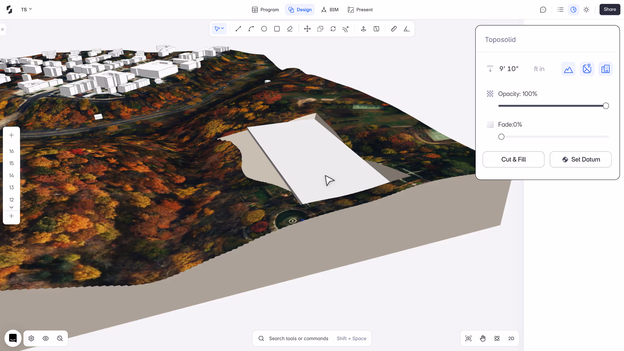
1. Model on real terrain
You can now import a contoured site as a Toposolid—a 3D terrain with volume. This makes it possible to site your building on the topography instead of just floating above it.
2. Cut & Fill made visual
Snaptrude will automatically compute where the terrain needs to be cut or filled based on your building’s footprint. Great for early grading studies without jumping into civil tools.
3. Control appearance
Customize how your topography looks. Adjust opacity and fade to generate clearer diagrams or overlays for presentation.
4. Easier datum setting
You can now quickly adjust the base level (“datum”) of the building to align it perfectly with your site context.
Why It Matters
This has been a top ask from users working in hilly or non-flat terrains. Before, Snaptrude couldn’t meaningfully support contoured sites, so everything happened on a flat plane. That meant workflows around grading, siting, and accurate context modeling were blocked.
Now, with Toposolids, early-stage site strategy is fully unlocked. You get a real feel of how your design sits in the landscape, right from day one.