August 21, 2025
3.26.0
Toposolid parcels

“With parcel imports from Regrid, architects no longer need to manually trace or approximate sites. Starting with accurate boundaries means cleaner site planning and faster project setup.”
– Azhar Poonawala, Sr. Product Analyst
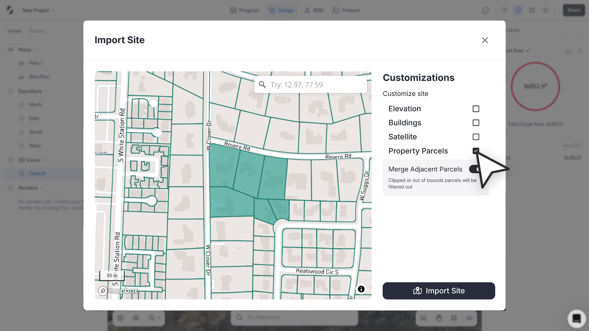
We’ve integrated Regrid parcel data directly into Snaptrude, making it possible to import real property boundaries for sites in the USA and parts of Canada. This helps architects work with accurate site extents right from the start.
What’s New
Parcel Import in Toposolids
- Available through Import Tab, Object Properties Panel, Sustainability Tab, and AI Kickstart workflows.
- A new Property Parcels checkbox appears in the site import modal (US + parts of Canada only).
- Toggle Parcel Layer to view and select parcels (available at map scales < 200m).
- Select up to 10 parcels at once.
- Choose between:
- Merge sites on import → adjoining parcels combine into one site.
- Separate sites on import → each parcel imports individually.
Automatic Site Areas
- Imported parcels automatically populate the Site Areas tab, giving you quick metrics for planning.
Sites as Departments
- Imported sites are grouped under a new “Sites” department (with default color matching topo).
- Site objects can be reclassified into other departments, but other objects cannot be reassigned into “Sites.”
Auto Datum Placement
- Datum is now set automatically where the imported site touches the toposolid, removing manual setup.
Topo Modal Enhancements
- New layer toggles:
- Elevations → contour lines
- Buildings → building footprints
- Satellite → satellite imagery
- Property Parcels → parcel boundaries
- Improved location search: Google coordinates now resolve accurately and center correctly.
- Set Datum in 2D in addition to 3D.